Railroad GIS: SZU sets course for digital


The Sihltal Zürich Uetliberg Railway (SZU) expects passenger numbers to double in the coming years. To keep pace with this growth, it sought a solution to make its infrastructure management more efficient and automate its reporting. SZU opted for digitalisation and, together with Basler & Hofmann, implemented a railway GIS.
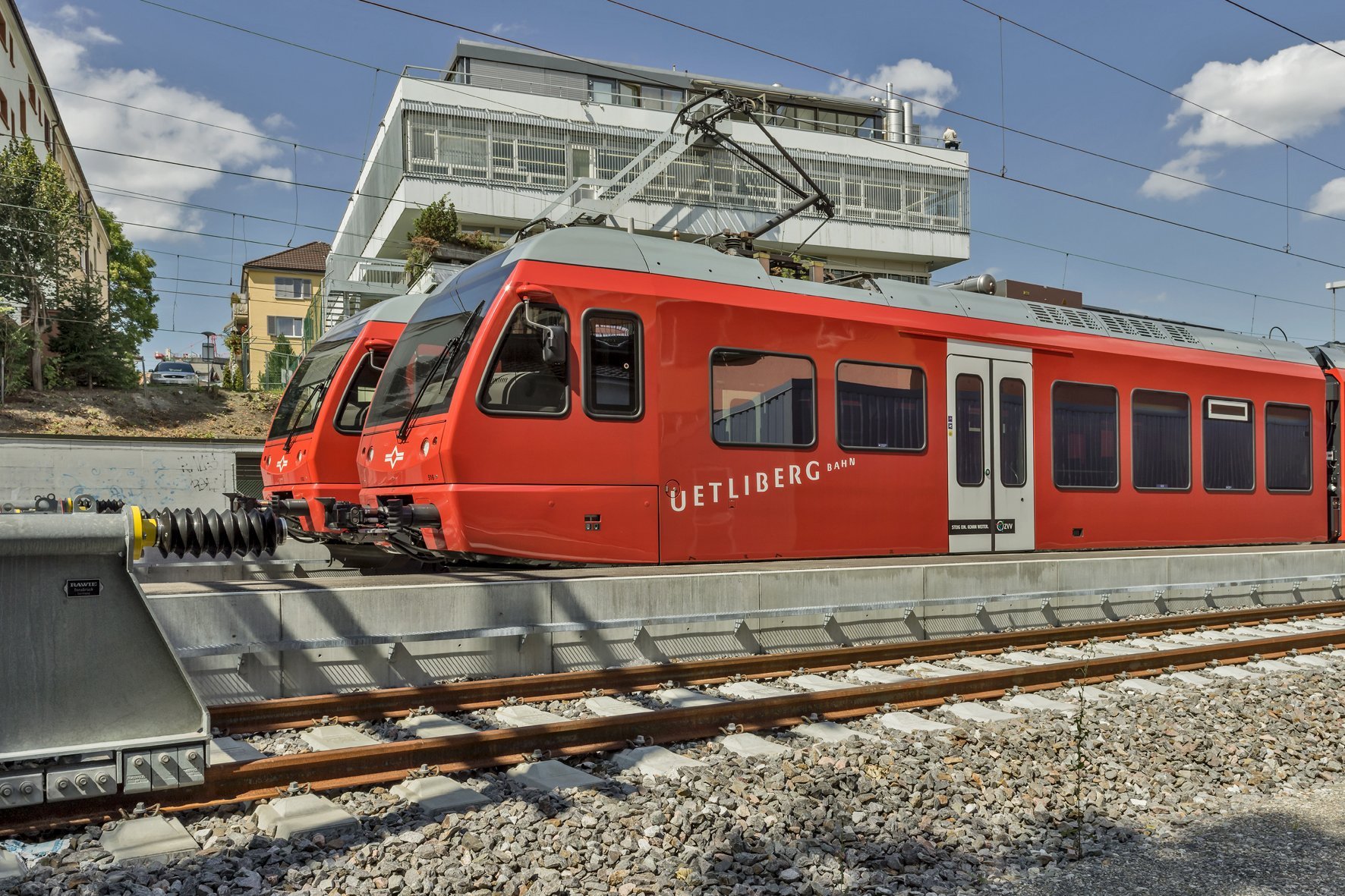
Without SZU, nothing moves in the south of Zurich. On its network of just 27.6 kilometres, it transports more than 15 million passengers per year in high-frequency regional transport in the greater Zurich area. By 2050, this figure is expected to rise to 30 million. To cope with this growth, the SZU is relying on its formula for the future, ‘SZU_4.0’. This is the name of the railway's modernisation programme, which will also increase the frequency of services.
Data management also needed to be modernised. Until recently, the railway did not have a central inventory system for its fixed installations. It worked with differently structured data sets, including conventional railway and maintenance plans, various lists and smaller Access databases. This practice was time-consuming. "If I have 30 or 50 railway plans, it takes a long time to find the right PDF," says Lukas Scheu, Head of Infrastructure Management at SZU, describing the situation at the time.
In addition, like all infrastructure operators, SZU must submit regular reports to the relevant supervisory authorities, such as the condition of the network to the Federal Office of Transport (FOT), the utility lines to the canton of Zurich's line register (LKMap) or on technical interoperability in accordance with EU requirements to the European Infrastructure Register (RINF). These reports tie up human resources. SZU therefore wanted a system change that would enable automatic data transmission in order to fulfil these obligations more efficiently.
This insight led to the kick-off of a systematic, digitalized process in 2022.
Wanted: the best railroad GIS solution on the Swiss market
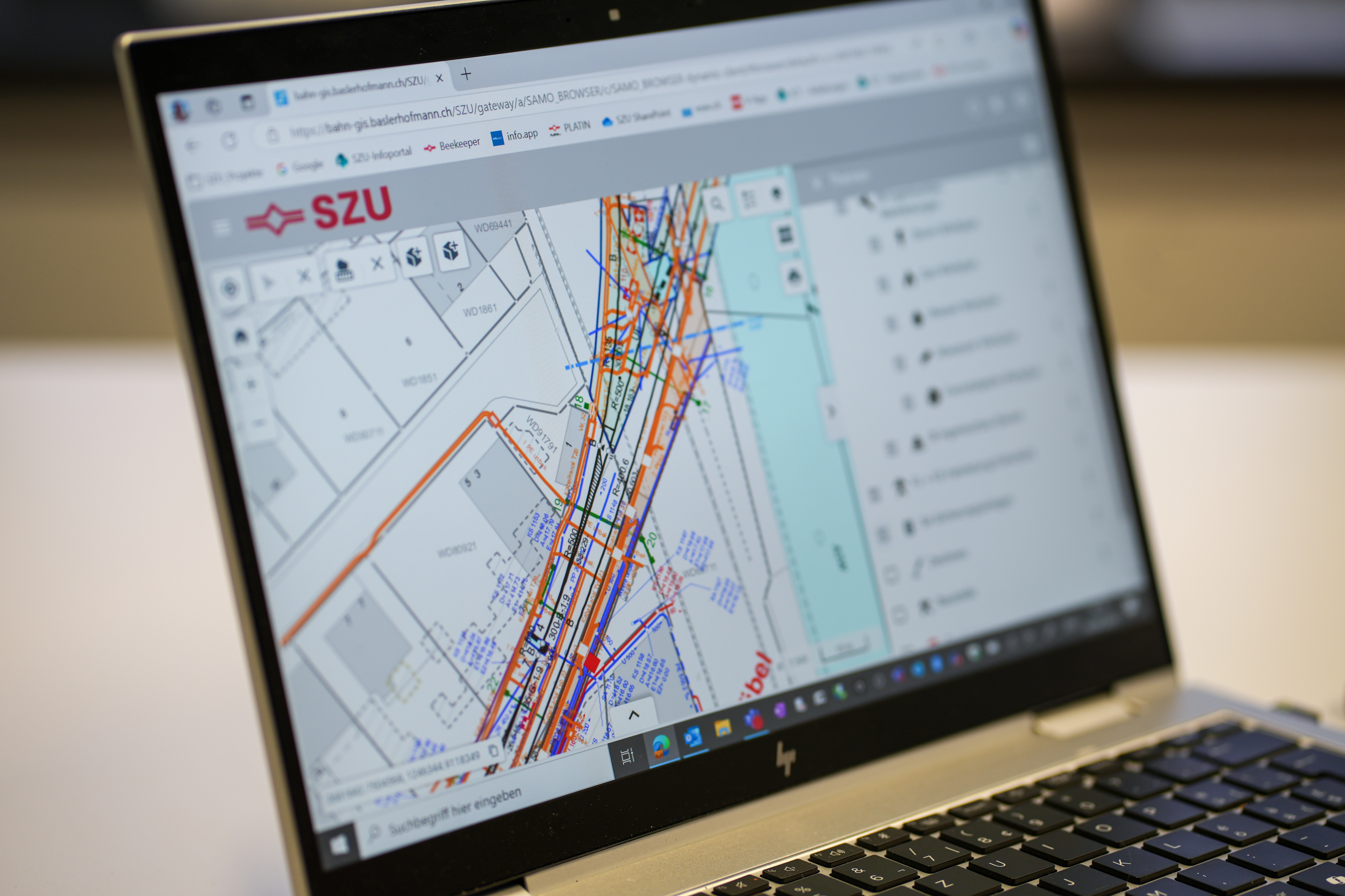
The company was looking for an advanced infrastructure management solution that would ensure information and data consistency across processes. Information on routes, safety systems, overhead lines, engineering structures and utility lines needed to be exchanged quickly, smoothly and without loss. All employees should have appropriate access to the information relevant to them, and the information should be stored in a central database that would become the source for all data.
Because this project involved considerable financial and operational risks, SZU approached the planned system change with caution. It commissioned an independent management consultant to evaluate the infrastructure management solutions in use throughout Switzerland. Interviews with 15 Swiss railways provided an overview of the available solutions. Infrastructure teams then developed twelve use cases that the desired new solution should support (e.g. data import, creation and printing of plans, display of disrupted objects on a map, etc.).
Four systems made it onto the shortlist. In the end, the SAMO LIDS solution from Asseco Berit, operated by Basler & Hofmann, was found to best meet the requirements.

GIS and railroad expertise in demand
GIS specialist Natalia Kudinova from Basler & Hofmann oversaw the introduction of the railway GIS for SZU. The implementation took place in two stages. In the first phase of the project, Natalia and her GIS team transferred SZU's railway plans to the new GIS system. From 2025 onwards, this was followed by building documentation, data from other systems and newly recorded survey data.
Although geoinformation systems are widely used today, there are special considerations to be taken into account in the railway sector. Special railway GIS solutions are needed that are tailored to railway-specific requirements and provide digital support for infrastructure management. Advanced railway GIS systems record, among other things, the track network, safety systems, overhead lines, engineering structures, utility lines and extensions such as noise registers and vegetation profiles. Linear georeferencing enables the exact location of all objects along the track axis. This allows for the systematic, spatially linked representation and analysis of the entire infrastructure – from the route network to technical details such as individual points or signals.
Positive experiences with the new railroad GIS
The SZU railway GIS is now proving its worth in operational use. It has helped the railway company to centralise data management, simplify processes and save resources. ‘The new system has been very well received by employees,’ says Lukas Scheu, Head of Infrastructure Management at SZU, adding: “The introduction of the railroad GIS was an important step that will help us to meet the challenges of the coming years.”
- Tip: Also read the interview with Lukas Scheu and Christian Peter from SZU.