2D becomes 3D: How GIS data is made into BIM models of infrastructure


BIM models - three-dimensional models - are increasingly in demand in infrastructure planning. If a road is to be renovated, for example, it is useful to be able to see the existing structures and pipes above and below ground in three dimensions (3D). Geoinformatics engineer Natalia Kudinova and her team create such vivid 3D BIM models from conventional 2D GIS data. We took a look over her shoulder.
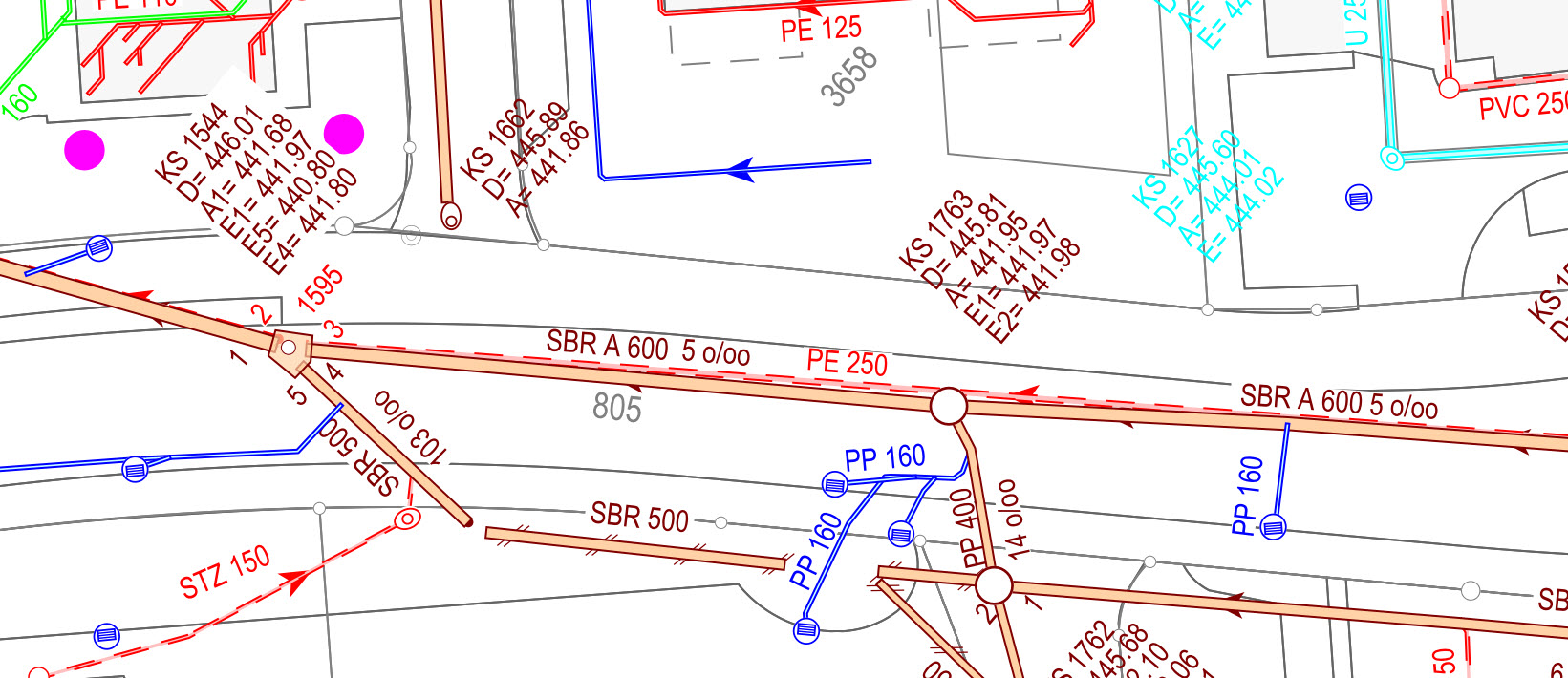
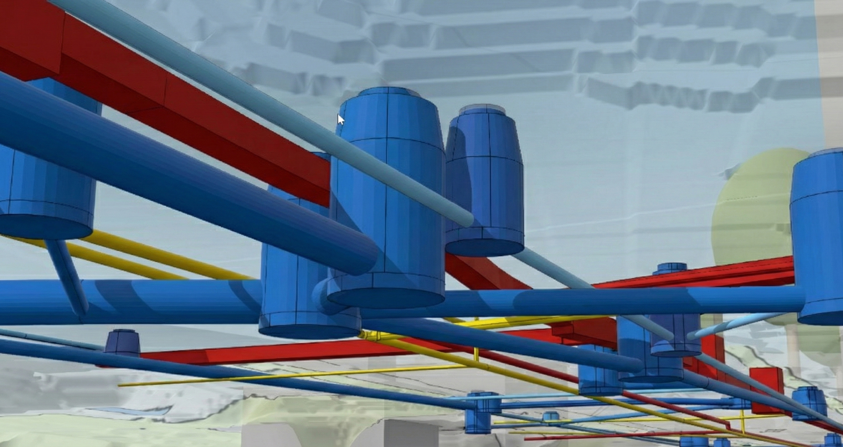
Natalia Kudinova moves her mouse across the screen. She opens the ArcGIS Pro program (Esri): we see a section of the cantonal road between Interlaken and Grindelwald. At first, only the road surface is visible, surrounded by shadowy trees and houses. With each click, more becomes visible: gas pipes, sewage pipes, electrical installations, telecom cables, then drinking water pipes.

Everything appears three-dimensionally represented in "solids", as these elements are called in Building Information Modeling (BIM) terminology. The 3D visualization is a digital image of the entire Infrastructure of the road section. Natalia's client, the Senior Engineering Circle I of the Civil Engineering Office of the Canton of Bern, will be able to plan and coordinate the redevelopment of the road near Interlaken on the basis of this model.
Natalia, why are 3D models of infrastructure facilities increasingly in demand?
Our customers - the federal government, cantonal and municipal utilities and municipalities - want to know the existing situation precisely in order to make decisions. They use the models for their planning, for example for renovation projects. Their engineers need to know what is located where, above and below ground, in order to plan the right measures. They want to know where the construction companies can and cannot drill, or where they need to drain.
Thanks to the 3D model with integrated geodata, planning and execution errors can be avoided. The combination of geodata and BIM is called GeoBIM. It is particularly useful for large concept designs, urban planning, infrastructure management or environmental issues.
Why is GIS data only available in 2D?
I need to clarify that. GIS data, the georeferenced data from geographic information systems (GIS), is not always only two-dimensional. In the case of drainage systems, for example, there is usually also height information that tells us how deep or high a pipe is. As a rule, however, GIS data is only available in two dimensions. There are historical reasons for this: GIS systems were once developed for maps and plans. Technical limitations and a lack of data sources meant that the third dimension was not systematically recorded.
When you create 3D BIM models from 2D GIS data: What is the challenge here?
As the height coordinate is often missing in GIS, we know where a cable is located underground, for example, but not how deep and what volume it has. In the case of wells, for historical reasons we often only know imprecisely where and how deep their pipes are laid. However, we need elevation data in order to create a 3D model. BIM has no tolerance for two-dimensional data.
Can you explain this non-tolerance?
In the BIM environment, there are only 3D objects. All data is represented as solids. Even a simple label, such as a parcel number, is represented as a solid. BIM does not accept data that lacks a third dimension. We are dealing with two worlds, the GIS world and the BIM world. The challenge is to bring these two worlds together.
How do you proceed if data is missing?
First of all, we need to find out from the client how precise the desired BIM models should be. If a high level of precision is required, the missing third dimension must be measured on site. A shaft, for example, would be surveyed using a total station. However, it is often sufficient to work with assumptions based on standards, such as the usual depth of service pipes: Water pipes are located at a depth of at least 1.5 meters so that they remain protected from frost and pressure loads, while wastewater pipes can be covered at a depth of just 0.8 meters.
To illustrate a lack of data, we sometimes work with oversized illustrations: For example, we then represent a well shaft with an unknown depth with a depth of 300 meters. Once the client is satisfied with our data logic, we translate all the data into a BIM model.
How does this work technically?
Basler & Hofmann has developed a computer program specifically for the translation of GIS data into BIM models. It calculates the 3D BIM model from all the data fed in. We then make the data available to our customers in the common IFC file format. This allows them to open the models in various programs and share them with consultants.
Let's look to the future. Will GIS and BIM one day become one?
I think the GIS systems will grow into the BIM world, so to speak. Then technical conversion will no longer be necessary. This integration has already been achieved in Norway, where the state has prescribed certain software formats across the board. In Switzerland, there is a lack of political pressure.
But this is the future: the integration of both worlds into one system. Given the complexity of modern infrastructure projects, comprehensive GeoBIM integration seems to me to be a must. We are therefore working very closely with cantons, municipalities and universities on GeoBIM topics, both within the framework of specialist committees and in ongoing projects.


